Engineering Survey
Engineering survey serves and support construction project by providing information for the construction project phase.
Topographical Survey
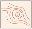
Topographic Survey to carry out land survey that focus on defining natural or man-made structures in the area. This can includes identifying existing trees, creeks, hedges and areas of sloping land. Man-made structures can include things like existing buildings, barriers, fences and landscaping elements. It gathers the data about the elevation of a points on a piece of land and present relief information on the plot.
Sample Project: Topographical Survey at Kg. Porak, Papar
Road, Waterway and Transmission Line Survey
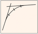
Transmission Line is one of the essential infrastructures of the power supply system and to achieve optimum line length, minimize rocky and water terrains, reduced tower angle cut points and others, it is necessary to have detailed survey. The detailed survey that included are detail of road, railway crossings, river crossing, trial pits etc.
Sample Project: Road Alignment Survey with Utility Detection at KM 7 Jalan Tuaran, Kota Kinabalu
Hydrographic Survey
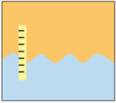
Hydrographic Surveying measures the ocean and rivers or any kind of waterway to produce detailed plans of seabed, harbours, and waterway showing depths, shapes, and contours. Some of the works involves the geomatic surveying or geospatial engineering – collecting the precise information needed to draw up all kinds of detailed charts, maps and plans.
Hydrographers may be involved in gathering information in:
- Producing charts and information related to navigation.
- Predicting the effects of proposed and existing marine developments on the environment.
Equipment used:
- Echo Sounder
- Single and multi beam
- GPS
Software used: HydroMagic.
Sample Project: Bathymetry Survey at Pulau Mengalum, Kota Kinabalu
Underground Utility Survey
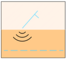
Underground Utilities survey is a survey to know the routes, location and depth of existing pipes, cables, sewer and other buried infrastructure. The final output is to produce the plan by using the Ground Penetration Radar (GPR) and PCL equipment.
The utilities that usually been detected are:
1. Pipes and cables included:
- Waterpipe
- Public Lighting
- Power Cable
- Telecommunication Line
- Sewerage Line
- Any unclassified cables
2. Manholes or Valves:
- Water valve
- Electric Cable Manhole
- TM Manhole
- Public Lighting Cable Manhole
- Sewer Manhole
Equipment used:
- Pipe Cable Locator (PCL)
- Electromagnetic Locator (EML)
- UTSI TriVue Triple Frequency GPR
- CHC i80 GNSS Surveying
- Sonde (S18)
- Radio detection Flexrod
- Magnetometer
Sample Project: Road Alignment Survey with Utility Detection at KM 7 Jalan Tuaran, Kota Kinabalu
Aerial and LiDAR Mapping
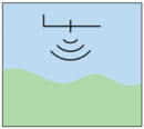
Aerial survey is a method of collecting imagery or produces the map of land and shore using the aerial vehicle such as Unmanned Aerial Vehicle (UAV).
An UAV able to collect detail data quickly and inexpensively for the smaller areas. UAV systems have proven efficient in many different situations, especially for the unreachable area.
Equipment used:
- DJI Phantom 3 Pro
- WingtraOne Fixed Wing
LiDAR scanning is one of the methods in aerial surveying, especially for large scale topographic and as-built surveying for land development, as-builds, environmental lands and building constructi0n. With LiDAR mapping, you can map large scale topography and get substantial and complex output in the process.
Sample Project: Aerial Photogrammetry for Perwira Quarry, Sepanggar
