Cadastral / Title Survey
Cadastral Surveying is the discipline of land surveying that related to the land ownership and the definition of the property boundaries. This may include the interpreting and advising the boundary locations on the status of the land ownership, re-establishing boundaries that have been surveyed or create new boundaries as part of the land subdivision process.

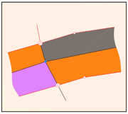
A survey to replace the missing or broken of boundary marks from its original position, to be based on the refixation calculations.
Sample Project: Re-survey for KOSAN along Jalan Tuaran, Kota Kinabalu
Providing land survey services for development project which include amalgamation and subdivision for obtaining individual title.
Sample Project: Conversion for mixed development of Mile 7 Airport Road, Sandakan
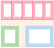
Subdivision of building for multistorey development to obtain subsidiary title.
Sample Project: Subdivision of Building – Wisma Layar-Layar, Kota Kinabalu

Establishment of GPS control network of first order for eventual cadastral survey adoption.
Sample Project: Control Point Positioning at Kg. Pogunon.
Land Acquisition Survey is carried out for the purpose of acquiring land for respective stakeholder such as JKR Road Development.
Sample Project: Land Acquisition Survey of Drainage for Department of Drainage
 Mining surveying helps to find the precious or non-precious metals and minerals by measuring mines, tunnels and other underground or surface works. The mining survey involves in all aspects of that includes the taking of accurate measurements and the preparation of accurate plans.

Land Application Survey is the survey for the issuance and preparation of the land title.
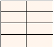
 Amalgamation Survey is the survey involves with the combination of two or more connecting or adjoining lots of isolated lands, without splitting any of any existing lots. Subdivision Survey is the survey when one or more parcels are broken up into more parcels, whether it can be land or units in the buildings.
Sample Project: Amalgamation and Subdivision of Building

Temporary Occupation License (TOL) is a license to occupy land for temporary period of time and for specific of purpose, usually issued with permits of extraction and mining.
Sample project: Survey for PT. 20-07160079 at Tenom
 Reserve Land includes Forest, Wildlife, National Park, Catchment Areas, Grazing, Native, Government or other similar reserves and each reserve may cover different types of terrain, such as flat, undulating, hilly, freshwater swamp, tidal swamp and many others.
Sample project: Survey of Land for Forest Reserve at Pensiangan